Announcement

Collapse
No announcement yet.

This Is Pictures.

Collapse
X
 
  • Filter
  • Time
  • Show
Clear All
new posts

  • mrsleeve
    replied
    Originally posted by LateFan View Post
    Very nice shots by you and Blackbird.

    Is this below the cascades at McDonald Creek, across the highway from Avalanche and Trail of the Cedars? If so, that's such a cool spot where the water falls through those slots. Harder to get to it from the backside like that. Also, Avalanche Falls is really cool and a mini rain forest, and anyone can see it on a totally accessible boardwalk trail.
    Nope that vantage point not far from the hidden lake trail head a logan. Less than a 1/2 mile form the visitors center at logan. That whole area is closed the entire season now, not even when snow cover is still on or right when the eveything is dead and the snow is starting will the park open that area anymore.

    Originally posted by LateFan
    As far as crowding, if people just drive over the top, they'll be blown away. If you ride a small bus, it's almost better because you can relax about driving off a cliff and actually see things, and you're rid of your panicked passengers who can't enjoy the view because you're driving next to cliffs! I saw more doing that once than I have riding a bike - too tired to look around going up, concentrating too hard on not going off a cliff going back down.
    LOL Yeah when we take guests and what not up they are always stomping on the brake in the pass/back seats, and my wife's aunt actually got mad at me for treating the drive up and over "like a sunday drive" and nearly hitting the rock and driving over the side...... In my defense is was sunday, you have to get close to the rock face an just because you cant see the edge does not mean there are not fee of road there. I can run that road in my sleep I have been over it so many times. In fact went to costco to get a lawn mower battery and ended up a logan for the evening

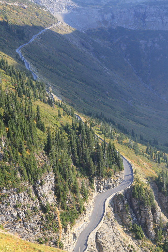
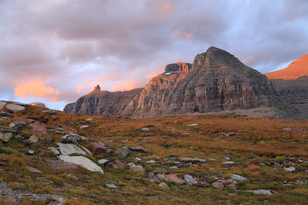
    1st time I hiked the upper end of the highline was late in the season and there was a little snow on it and the hose/cable was already removed for the winter. I remember the hiker bailing off from a couple years ago, wife/mil/and some family were in the park that day but over at many glacier when that was going on....


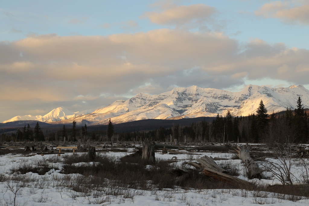
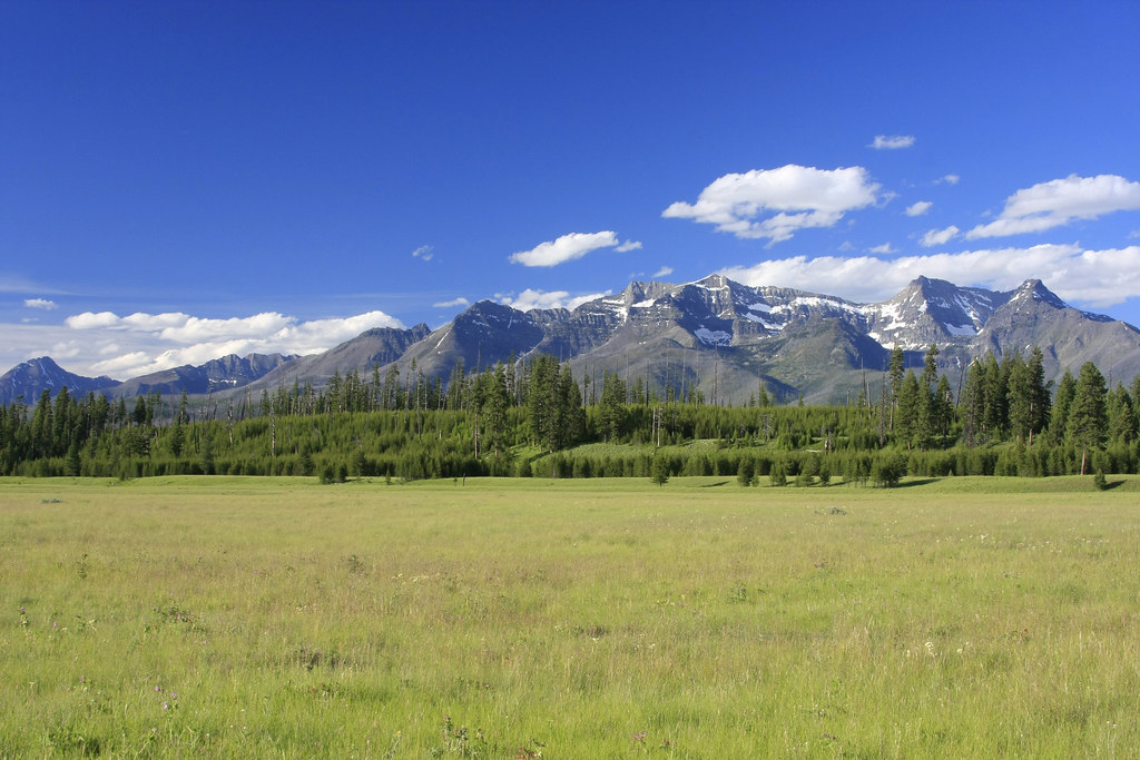
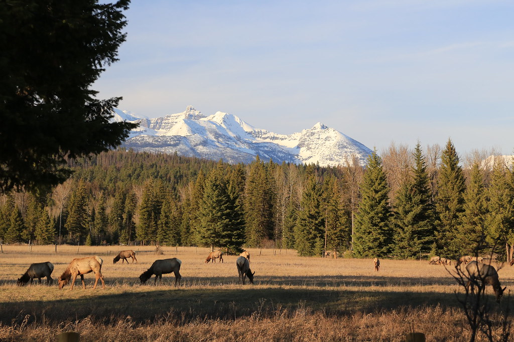
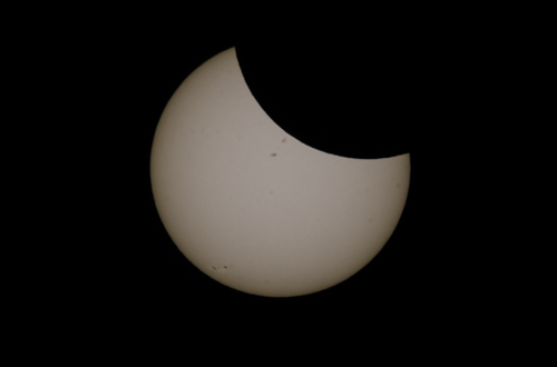
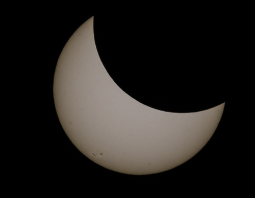
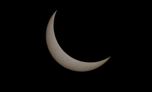
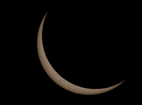
    from WAY WAY up the northfork.

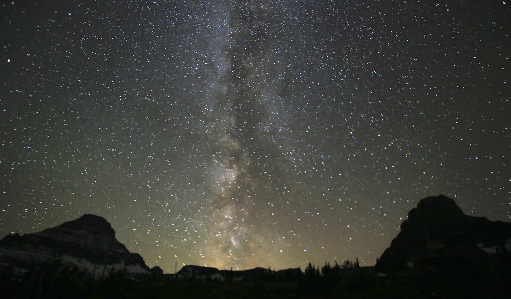
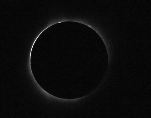
    IMG_4934 by mrsleeve, on Flickr
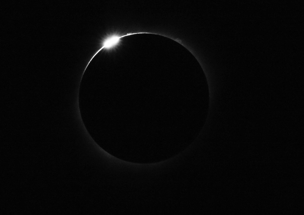
    Leave a comment:


  • M-technik-3
    replied
    Originally posted by 2mAn View Post
    I hiked in Glacier National Park in probably 2010. My friend took some pretty awesome pictures. I'll have to dig them up. That place was beauty upon beauty. Sad that the Chalet burned. We went at the end of June and the road to the sun (I think that's what it's called) wasn't open all the way across, so we drove up one side, then went around the other side. I miss the PNW.

    I always wanted to camp at the national forest that Will was at too. A freaking rain forest !! What an amazing place to be.

    I have not been to GNP since the mid 90's when I was out at Fairchild AFB for Survival school in winter, all of my photos are on 35mm and long gone. :( If you want to hike on a glacier you better get to Alaska or Montana soon as they are rapidly receding. The ice age is gonne be here in a few years.

    Leave a comment:


  • LateFan
    replied
    [ATTACH]116794[/ATTACH]

    [ATTACH]116795[/ATTACH]

    [ATTACH]116796[/ATTACH]

    [ATTACH]116797[/ATTACH]

    "The on-scene firefighters had apparently been battling an “ember shower” from the approaching fire when they suddenly noticed puffs of smoke under an eave. They immediately sprayed the area with water as they thought it was an ember on the roof. Almost instantaneously, however, the window broke out and flames were licking at the eaves."

    “The fire team has worked tirelessly to contain this fire and protect structures and infrastructure,” said Glacier National Park superintendent Jeff Mow. “The environmental conditions were absolutely extreme yesterday, as high as anything we’ve seen so far this summer.”

    “The firefighters, supported by four helicopters that flew until last light, made a valiant stand to save the structures,” she said. “They were unsuccessful in saving the main building at the Sperry Chalet. They worked through the night to protect the four remaining structures."

    "Mow said that the structures at Sperry Chalet are iconic historic structures that are widely loved by park employees and visitors all over the world."

    Leave a comment:


  • LateFan
    replied
    Originally posted by mrsleeve View Post
    Over 2 million people a year walk with in 200 yards of here and never see it and it can been seen from the most popular trail in the park, Just not from this vantage point ;)
    Very nice shots by you and Blackbird.

    Is this below the cascades at McDonald Creek, across the highway from Avalanche and Trail of the Cedars? If so, that's such a cool spot where the water falls through those slots. Harder to get to it from the backside like that. Also, Avalanche Falls is really cool and a mini rain forest, and anyone can see it on a totally accessible boardwalk trail.

    As far as crowding, if people just drive over the top, they'll be blown away. If you ride a small bus, it's almost better because you can relax about driving off a cliff and actually see things, and you're rid of your panicked passengers who can't enjoy the view because you're driving next to cliffs! I saw more doing that once than I have riding a bike - too tired to look around going up, concentrating too hard on not going off a cliff going back down.

    Then, just like Yellowstone, if you don't try to see everything between 10 and 2, it's much quieter. If you walk 200 yards off the highway on any trailhead, you enter a different world. That Highline trail leaving the top of the pass would freak most people! I had little kids on it once and it was not fun. That same trip, the older one got impatient, ran ahead, and popped out of trees into a clearing where a mama grizzly and her cub were digging right off the trail. 20' away. For some reason, she just looked straight at him, then ignored him and went back to dragging the little one back and showing him how to dig up roots. He didn't die that day for some reason. People took telephoto shots, a ranger interviewed him later. After that, people on the trail clustered into little clumps of a dozen - nobody saw where she had gone.

    Just for fun for everybody, here's the start of the Highline trail, about 100' straight up above the highway. There's a cable with a garden hose to hang onto.
    Click image for larger version

Name:	140923_bigsur_by_alyxschwarz_690p2.jpg
Views:	1
Size:	102.1 KB
ID:	7192913

    A guy managed to climb down to the edge of the cliff (white dot) to avoid a grizzly (brown dot) using the trail, 'cuz it's the only way through there.
    Click image for larger version

Name:	grizzly.jpg
Views:	1
Size:	92.5 KB
ID:	7192914

    Leave a comment:


  • flyboyx
    replied
    nice shots you guys!

    Leave a comment:


  • LateFan
    replied
    Yeah, check out the Hoh rain forest on the west side of the Olympics - mind boggling huge plants, it's crazy! And there's a long stretch of wilderness beach you can backpack, that's separated from most of the mainland by Lake Ozette. Wild and stormy.

    Olympic is cool because it's mountains and peaks and glaciers, then rain forests, then that wild ocean shoreline.

    Moss, ferns, green fuzz everywhere.
    Very large slugs.
    Bigfoot lives there.

    Click image for larger version

Name:	Hall-of-Mosses-Hoh-River-Valley-rainforest-in-Olympic-National-Park-1024x676.jpg
Views:	1
Size:	121.4 KB
ID:	7192911

    Click image for larger version

Name:	us-olympic-national-park-neah-bay.jpg
Views:	1
Size:	68.2 KB
ID:	7192912

    Click image for larger version

Name:	maxresdefault.jpg
Views:	1
Size:	81.9 KB
ID:	7192908

    Click image for larger version

Name:	img_4229-version-2.jpg
Views:	1
Size:	116.8 KB
ID:	7192909

    Click image for larger version

Name:	Washington Coast 2.jpg
Views:	1
Size:	103.4 KB
ID:	7192910

    Leave a comment:


  • mrsleeve
    replied
    ^
    In general if you want to make Logan pass its open by the 4th most years, and a lot of the time it is right at the end of june when they open the gates. Though I think is 11 and 14 that the pass was not cleared until the week after the 4th.

    its getting very very bad for overcrowding the last couple of years, though. We stuffed a million people though the gates in july alone this year, and a normal year is about 2.2m from Jan-Dec. I think it wont be long that the ability to drive over the pass on the sun road is going to be very limited in a personal ride to a voucher system and the bulk of the transporting is going to be like Zion in UT where its tour bus only during peak season. We have science types doing noise studies in recent years and some things about how all the "visitors" are affecting critter mating habits and what not. I think the ability to see GNP, like we are used is going to change dramatically in the next the decade. There have been large areas that have been cut off from any visitation in the alpine reaches, even during snow cover and late season when the plants are dead in recent years.


    Here are a few of my fav personal shots of the park

    the sun road from the high Line

    IMG_2694 by mrsleeve, on Flickr

    The day we had Logan all to our selves with out any one else there......... took this on the walk up
    IMG_2314 by mrsleeve, on Flickr

    Shot at Logan pass
    1st stack by mrsleeve, on Flickr

    Northern Lights over Lake MacDonald
    IMG_1744 by mrsleeve, on Flickr

    Over 2 million people a year walk with in 200 yards of here and never see it and it can been seen from the most popular trail in the park, Just not from this vantage point ;)
    IMG_2822 by mrsleeve, on Flickr

    Deep in the north western area of the North fork
    _MG_6160 by mrsleeve, on Flickr

    Logan in June of 13 a couple days after opening still about 5 feet of snow
    P6230700 by mrsleeve, on Flickr

    while private land in the foreground that is GNP in the back drop
    IMG_0906 by mrsleeve, on Flickr

    And 1 of my fav sunset shots of all time from Logan "someplace" in the fall
    IMG_2858 by mrsleeve, on Flickr

    I have had this shot from "the loop" looking east up the garden wall as the screen backdrop in my phone since the Day I took it nearly 3 years ago. Likely one of my best photos I have taken in my life, to me anyway.

    IMG_2942 by mrsleeve, on Flickr

    Leave a comment:


  • 2mAn
    replied
    I hiked in Glacier National Park in probably 2010. My friend took some pretty awesome pictures. I'll have to dig them up. That place was beauty upon beauty. Sad that the Chalet burned. We went at the end of June and the road to the sun (I think that's what it's called) wasn't open all the way across, so we drove up one side, then went around the other side. I miss the PNW.

    I always wanted to camp at the national forest that Will was at too. A freaking rain forest !! What an amazing place to be.

    Leave a comment:


  • agent
    replied
    Those eclipse pics are great!

    Leave a comment:


  • BlackbirdM3
    replied
    So how many of you have put 2500 miles on your E30s in a week? I made a last minute dash north for the eclipse. Made it to my mothers place in Sequim WA in 15 hrs. It was a very fast trip, went up on Thursday, home on Monday.

    Got to check out Lake Crescent in Olympic National Park. That place is amazing.


    Off my mothers back deck.


    Monday Morning I packed up and headed for McMinnville OR to see the eclipse. I got down there right as it was starting. (Exactly the time I wanted to get there.)


    I was so mesmerized by the totality that I failed to slow my shutter speed down enough to get any of the corrona. I'm doubly ticked at myself about that. So much so that I packed up my gear and headed south without checking out the museum. My reward? 6 hours of stop and go to get from Salem to Eugene. I got home about 3 am.

    Will

    Leave a comment:


  • mrsleeve
    replied
    Holy shit, been to busy at work.to keep up with the news, wife told me today that sperry burnt....... I was thought Sprague was under control..... fuck....... I have not made that hike in a couple years, never going to be the same sad sad day.....


    Thanks for the update Late....

    Leave a comment:


  • LateFan
    replied
    A few weeks ago a lighting fire started in the Sprague Creek drainage, between Lake McDonald Lodge and the chalet. After a few days they closed the trail and shooed everyone out of the chalet. Some chose to go out out 17 miles the other direction over Gunsight Pass (ouch... we've done that). I read that 3 older people were helicoptered out.

    So they had to shut down the chalet for the season and button it up. The family that has run it for two generations probably lost a lot of money. The air quality was so bad down at Lake McDonald that they closed the lodge two days ago. The fire was "under control" we were told, but high winds were predicted Thursday. The structures were wrapped and hoses and pumps were running, helicopters scooping from the lake. Last night word came that the chalet had burned down.

    No word yet if the rock walls are standing or if it all collapsed. It would be a monumental task to rebuild it, with materials and huge logs helicoptered in, and a 4 month building season. Millions. And it will never be the original building you're staying in.

    Initial trail closure down below.
    Click image for larger version

Name:	Sperry trail smoke.jpg
Views:	1
Size:	114.4 KB
ID:	7192903

    From Lake McDonald
    Click image for larger version

Name:	Sprage fire flames.jpg
Views:	1
Size:	66.6 KB
ID:	7192904

    Click image for larger version

Name:	Sprague fire lake.jpg
Views:	1
Size:	10.8 KB
ID:	7192905

    Click image for larger version

Name:	Sprague fire lake sky.jpg
Views:	1
Size:	60.7 KB
ID:	7192906

    They just released this pic. You can see the foil on the windows. In another pic there are hoses on the roof. And you can see flames in the upper windows. There were only 5 guys left up there, so I assume they were a bit busy to be taking photos. The dining building roof caught first, they put that out, then the chalet building caught.
    Click image for larger version

Name:	Sperry Chalet on fire.jpg
Views:	1
Size:	56.6 KB
ID:	7192907

    Leave a comment:


  • LateFan
    replied
    [ATTACH]116775[/ATTACH]

    1913. Materials hauled up by mule. No roads, no helicopters. Old Italian stone masons used huge boulders from the cliff.
    [ATTACH]116776[/ATTACH]

    [ATTACH]116777[/ATTACH]

    Great Northern Railway in white rocks
    [ATTACH]116778[/ATTACH]

    [ATTACH]116779[/ATTACH]
    Last edited by LateFan; 09-01-2017, 04:25 PM.

    Leave a comment:


  • LateFan
    replied
    It's a stunning place. There are several long finger lakes up on the plateau where the ice carved out straight hollows in the rock, then it drops straight off into Floral Park. They only melt for a few weeks. Although you're not very high right here, under 8000 feet, this place has its own climate that's very different from say Colorado at 8000. Timberline is about 6500-7000 feet for instance. The peaks are around 10,000, a few are higher.

    [ATTACH]116765[/ATTACH]

    Science Man on the edge of the ice to do some measuring. The pink is algae that grows on the snowfields in the summer.
    [ATTACH]116766[/ATTACH]

    Leave a comment:


  • LateFan
    replied
    One of the great things about Sperry Chalet is it gives you a base to hike up the cliffs to see Sperry Glacier itself, which is on the backside of the ridge far above the lodge, on the north-facing slope. You start at about 6500 feet.

    It's quite a hike, pretty steep, crossing raging streams (which are that completely cool grey-green color from all the minerals melting out of the ice), and switchbacking across a huge cirque until you get to the cliff at the top. You pass through massive basins of garage-sized boulders and turquoise pools that are just in he process of melting depending on the date, furry marmots trottling (is that a word) across the moss and rocks. It is the coolest.

    There's the chalet on the right in the trees, with the green roof. The dining building is to the left on the rock shelf, about the lower center of the pic. Beyond is the bowl / cirque and the cliffs you'll traverse to get up to that saddle in the center. You can't see the top from this angle.
    Click image for larger version

Name:	1 sperry chalet shelf.jpg
Views:	1
Size:	118.7 KB
ID:	7192891

    These are the series of terraces and pools you'll hike around. Note that tiny grey vertical slice at the far right of the cliff beyond...
    Click image for larger version

Name:	2 glacier basin hike.jpg
Views:	1
Size:	125.1 KB
ID:	7192892

    Looking back down over a shelf
    Click image for larger version

Name:	3 glacier basin pool.jpg
Views:	1
Size:	121.7 KB
ID:	7192893

    At the cliff at the top, there was a crack in the rock that they widened and carved steps into, with a cable to grab onto. We've gone back down when some big goats decided they had the right of way.
    Click image for larger version

Name:	4 glacier trail notch.jpg
Views:	1
Size:	88.7 KB
ID:	7192894

    You emerge at the top of the world. This is looking back the other way. That saddle to the right, in between the peaks, is where you come up the cliff and onto the top. There are massive snowfields, and the glacier itself is the upper left. You have no sense of scale up there - no trees, things are far apart. It felt like being on the moon. Down below in this pic is a huge area called Floral Park for all the wildflowers. Many inexperienced hikers have fallen off cliffs here and aren't found 'til spring, or are eaten by grizzlies.
    Click image for larger version

Name:	5 top of the world.jpg
Views:	1
Size:	82.1 KB
ID:	7192895
    Last edited by LateFan; 09-01-2017, 04:48 PM.

    Leave a comment:

Working...
X